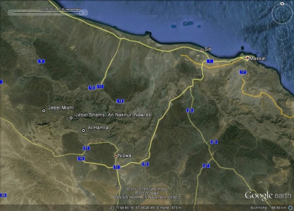
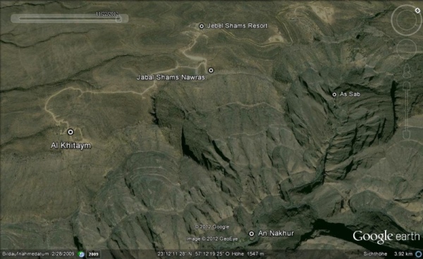
Nawras is about 30 km from Al Hamra away. It's above Wadi An Nakhur and you have a beautiful view into the Grand Canyon. It's about 750 m after the Jebel Shams Resort and 2 km before Al Khitaym, where the trek starts to the Abandoned Village.
| Location |
|
Nawras is about 30 km from Al Hamra away. It's above Wadi An Nakhur and you have a beautiful view into the Grand Canyon. It's about 750 m after the Jebel Shams Resort and 2 km before Al Khitaym, where the trek starts to the Abandoned Village.
|
| Equipment |
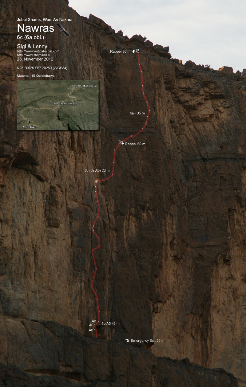
| Nawras is fully equipped. You need 15 quickdraws and some slings for A0. You need 60 m half ropes, to be able to get down to the start of the route. And of course the normal equipment you need for climbing a multi pitch route. |
| Getting down |
|
The first abseil point of Nawras (N23.20525 E57.20259 (WGS84)) is north of the parking place of the car. It's equipped with one bolt and one rock tunnel and are connected with a cord. Abseil 30 m to the left to the second abseil point. From there it's an other 60 m to the base of the route. You should see one bolt with a ring as Emergency Exit to get down to the path. The start of the route is to the left. |
| Route Description |
|
1st pitch: 6b A0, 45 m, 15 bolts. The rock of the start is very bad. We put 3 bolts to A0 the overhang. The rock quality of the 1. pitch is unfortunately not as good as the next two pitches. We cleaned a lot, but there might be still loose stuff. So be carefull when climbing the first pitch. 2nd pitch: 6c (6a A0) 20 m, 6 bolts. The crux is right at the start from the first belaystation. Right after the first bolt behind the edge is the second bolt. So you could A0 the crux. It traverse to the right before it goes up to the second belaystation. The rock is solid. 3rd pitch: 6a+ 35 m, 11 bolts. Traverse to the left before it starts to get straight up for an other 20 m. |
| Emergency Exit |
|
All belaystation in the route have two fixpoints and are equipped for abseil. The emergency exit allows you to get down the 25 m wall. From there you can hike down towards the hiking path of the Abandoned village. Be aware that there is an other drop before you reach the path. We hiked towards Al Khitaym, where we found a gap. An there were some trees and we abseil there another 25 m to the path. |
| Copyright (c) 2012 by Sigi Wirth & Leonhard Pang, http://www.vertical-alpin.com, http://www.steimann.li |
 |